Legends of Ancient Civilizations Beneath the Ocean
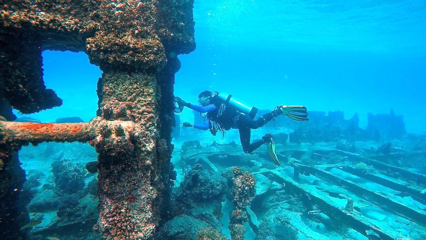
Shrouded in mystery, the legends of Atlantis, a highly advanced civilization described by the Greek Philosopher Plato, are thought to have been submerged beneath the Atlantic Ocean thousands of years ago.
Source: Wikimedia
While no evidence of the city has ever been discovered, researchers have found proof of several other ancient regions which now lie beneath the waves. One lost civilization discovered in Western Europe has fundamentally changed archaeologists’ understanding of the region.
The Ancient Doggerland Region
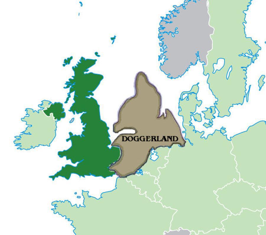
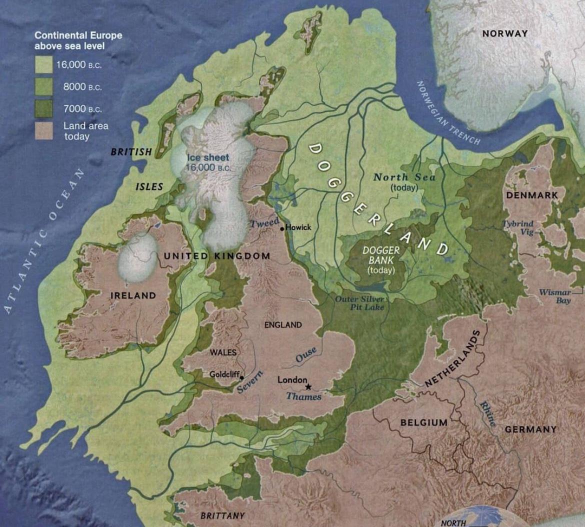
Today, the British islands remain isolated at the furthest stretch of Western Europe. However, as little as 8,000 years ago, they belonged to an extensive landmass now referred to as Doggerland, named after a submerged sandbank 60 miles off the English coast.
Source: Wikimedia
This landmass connected Britain to modern Belgium, the Netherlands, and southern Scandinavia. Here, an ancient civilization thrived, one that archaeologists are only now beginning to understand.
A Paradise For Neolithic Hunters
Doggerland would have been a paradise for the Neolithic humans. The region, now beneath the North Sea, would have been full of animals, fish, and plant life, all of which could sustain the growing population. These humans, who were skilled hunters and gatherers, likely lived in small, close-knit communities and relied on the abundant natural resources for their survival.

Source: Wikimedia
Archaeologists have long suspected migration occurred due to the steady food supply, and over many decades, thousands of archaeological items dating back to this civilization have washed ashore from supposed Doggerland settlements.
Archaeologists Employ Cutting-Edge Technology
It thought Doggerland was made up of numerous individual groups that likely interacted with each other. However, it has proven difficult to say with certainty just how extensive the settlements were.

Source: Freepik
To gain further insight into this lost civilization, archaeologists employed the help of oil companies drilling in the region, who had access to cutting-edge magnetometry technology. This involves using ground-penetrating radar to record the magnetic fields in a certain area. The results reveal unusual anomalies that could be the remains of ancient settlements.
PhD Student Sheds Light on Scanning Doggerland
PhD student Ben Urmston from the University of Bradford explained the process of magnetometry. “Small changes in the magnetic field can indicate changes in the landscape, such as peat-forming areas and sediments, or where erosion has occurred, for example in river channels,” he said.

Source: Wikimedia
He continued, “As the area we are studying used to be above sea level, there’s a small chance this analysis could even reveal evidence for hunter-gatherer activity. That would be the pinnacle.”
The Vast Doggerland Region
Doggerland once covered a vast region, so it’s difficult for archaeologists to pinpoint where many settlements were situated. However, using ground-penetrating magnetometry can help in their research efforts.
Source: @historyinmemes/X
“We might also discover the presence of middens, which are rubbish dumps that consist of animal bone, mollusk shells, and other biological material, that can tell us a lot about how people lived,” said Urmston
Significant Find
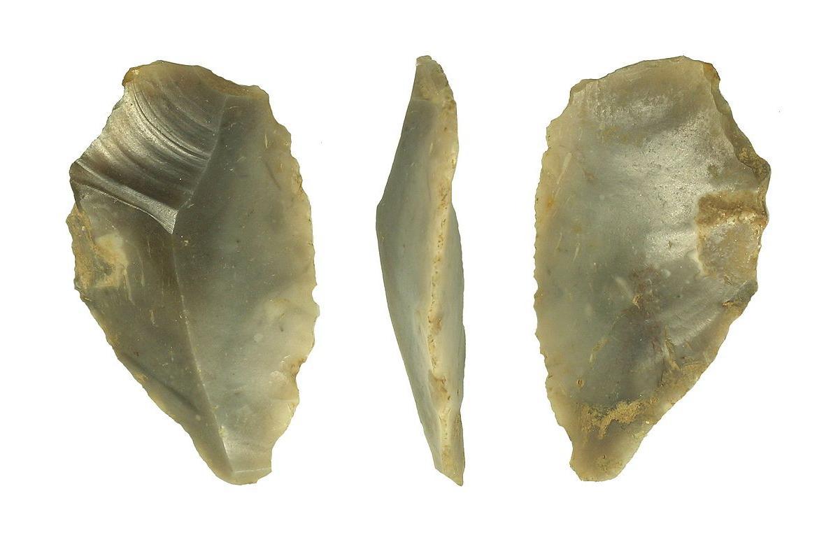
According to Dr. Sasja van der Vaart-Verschoof, the assistant curator of the National Museum of Antiquities in Leiden, one of the most significant finds from the Doggerland region thus far is a prehistoric tool that could be around 50,000 years old.
Source: Wikimedia
It was a small, worked piece of flint held in place using a type of sticky resin collected from a birch tree known as pitch.
Neanderthals Capable of Highly Complex Tasks
According to Dr. Van der Vaart-Verschoof, the artifact provided researchers with evidence that the Neanderthals of Doggerland were “capable of precise and complex multi-staged tasks.”
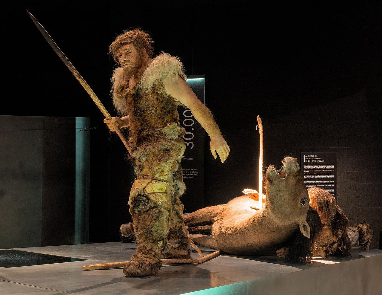
Source: Wikimedia
The discovery of such items has not only revolutionized our understanding of the older human species but also shed light on their complexity and intelligence, challenging our preconceived notions.
What Happened to Doggerland?
At its greatest extent, Doggerland covered an area of around 185,000 km2. It is thought that early humans lived in the region from as early as 50,000 years ago until it eventually met its doom due to rising sea levels at the end of the last Ice Age.

Source: Wikimedia
While the sea only rose by around six feet every hundred years for a millennium, eventually, after 2,000 years, Doggerland was transformed into numerous low-lying islands. However, the natural disaster that followed would be the final nail in the coffin.
Tsunami Obliterates Doggerland
Over 8,000 years ago, an underwater landslide off the Norwegian coast led to a devastating tsunami that destroyed almost all that was left of Doggerland.

Source: Wikimedia
According to University of Bradford archaeology professor Vincent Gaffney, “If you were standing on the shoreline on that day, 8,200 years ago, there is no doubt it would have been a bad day for you.”
The Devastating Effects of Climate Change
Speaking on Doggerland, Van der Vaart-Verschoof said, “There was a period when Doggerland was dry and incredibly rich, a wonderful place for hunter-gatherers.”

Source: Freepik
She continued, “It was not some edge of the earth or land bridge to the UK. It was really the heart of Europe. There are lessons to be learned. The story of Doggerland shows how destructive climate change can be. The climate change we see today is manmade, but the effects could be just as devastating as the changes seen all those years ago.”