NASA Satellite Picks Up Temporary Lake in Death Valley
A NASA satellite has shared remarkable images of a temporary lake located in California’s barren Death Valley.
Source: Wikimedia
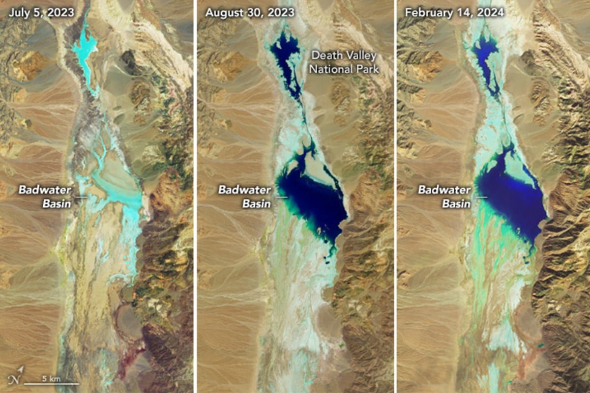
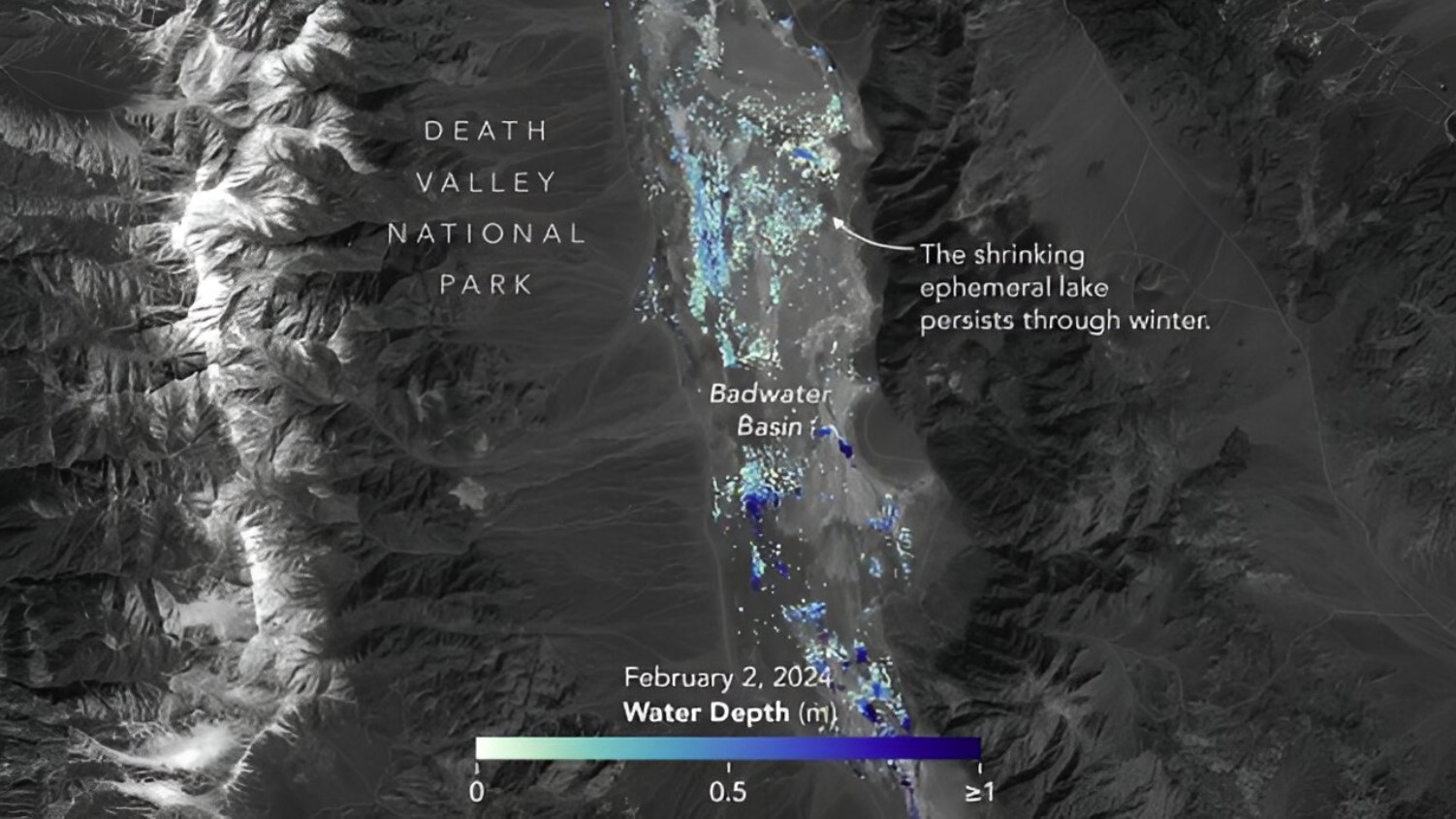
According to NASA Earth Observatory, the lake first appeared in the wake of Hurricane Hilary in August 2023. While it gradually shrank, heavy rainfall this past February filled the lake once more.
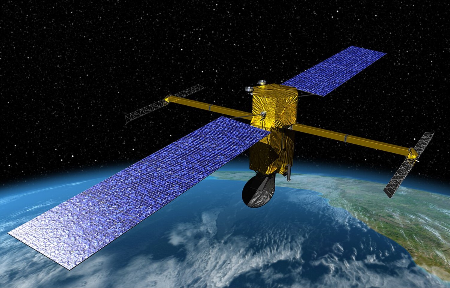
The Surface Water and Ocean Topography Satellite
The Surface Water and Ocean Topography Satellite (SWOT) is a NASA initiative funded by the US and France.
Source: Phys.Org
Satellite imagery from SWOT captured detailed photos of Lake Manly appearing in Death Valley’s Badwater Basin during the hurricane and following its culmination. It also photographed the lake after the most recent rainstorm.
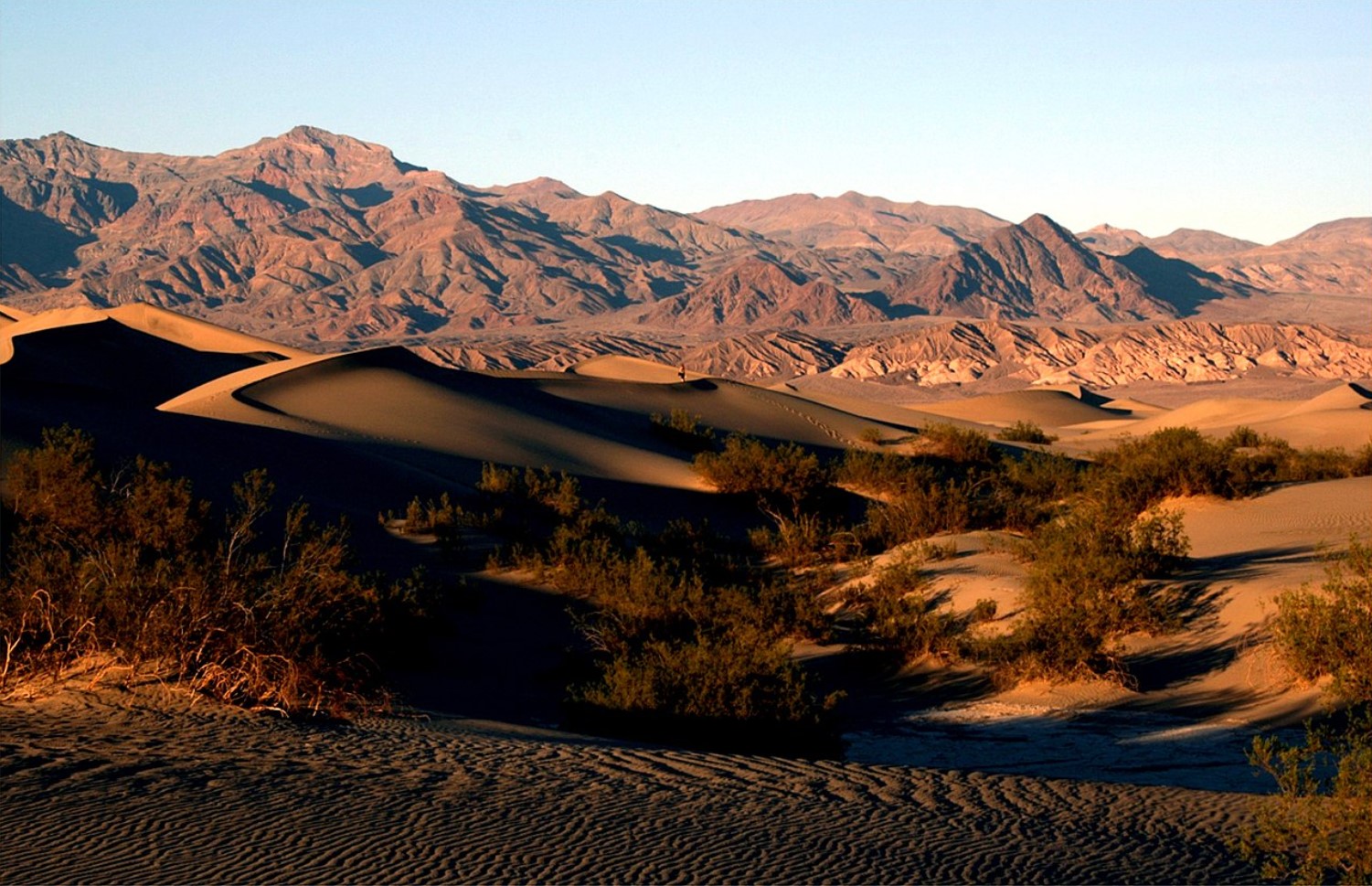
The Origin of Lake Manly
During the last glacial period, the Badwater Basin was home to an enormous lake that stretched 700 feet below the water’s surface. However, it has since been extinct for 10,000 years.
Source: Wikimedia
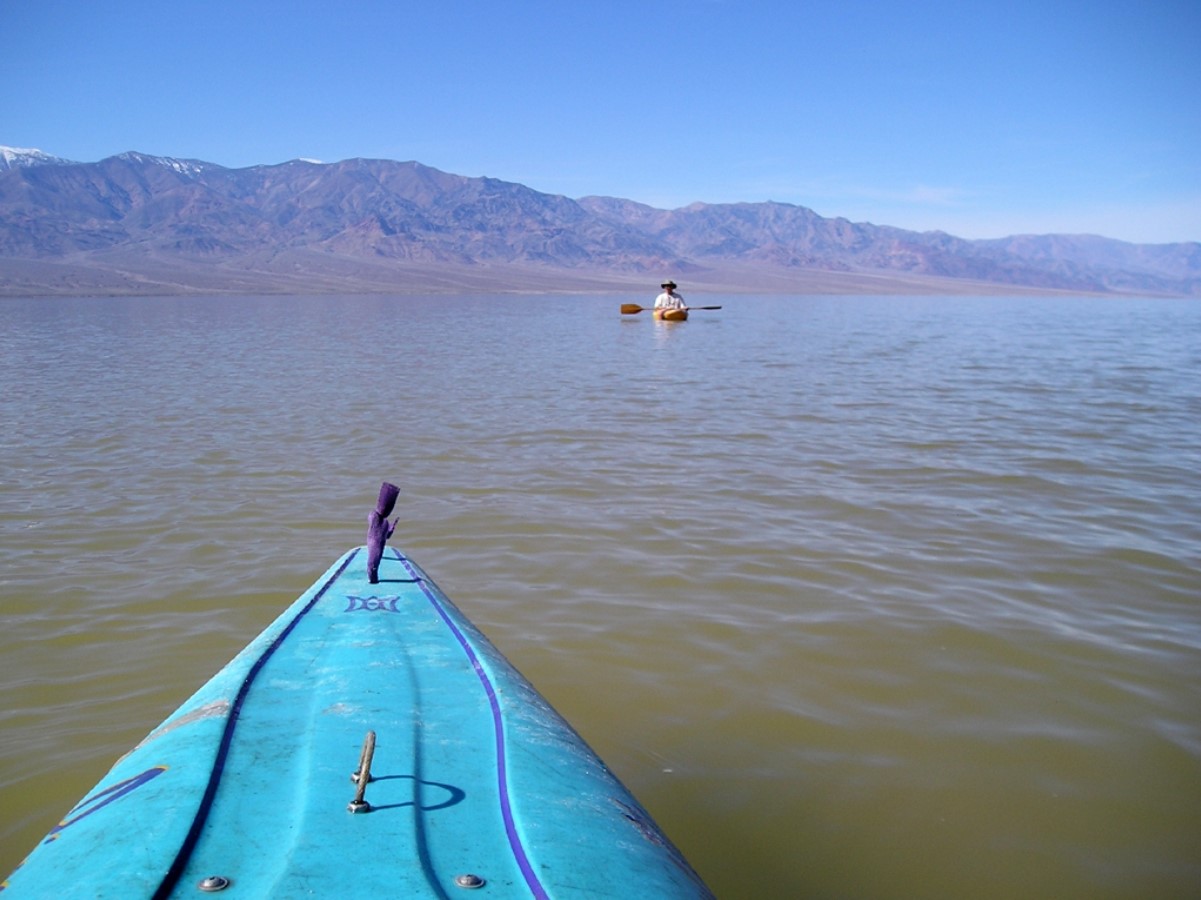
However, due to the previously mentioned hurricane and increased rainfall in the region, Lake Manly has remained a popular tourist spot over the past year.
NASA Shares Unique Image of Lake Manly on X
NASA Earth, an affiliate of the Space Agency, posted its thoughts on the filling of Lake Manly on X.
Source: @NASAEarth/X
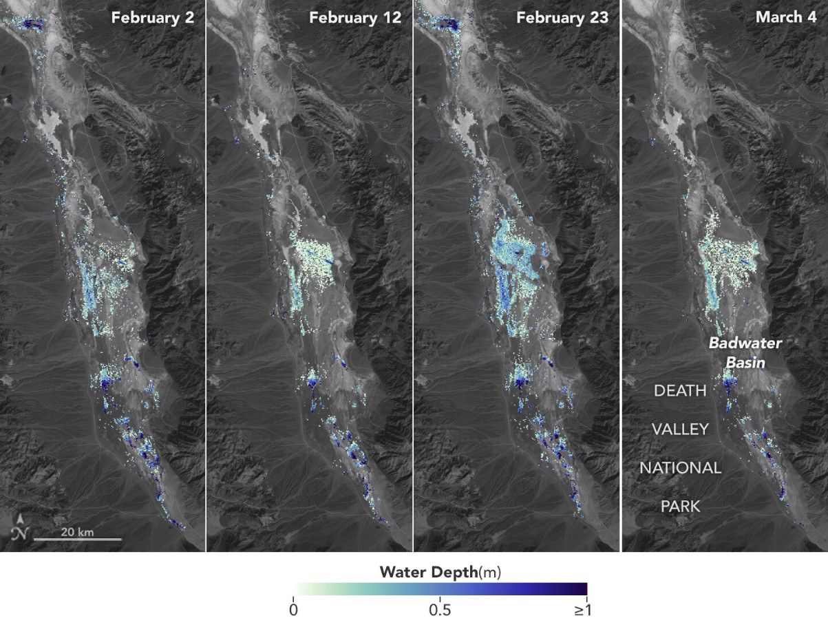
“This temporary lake in Death Valley is extending its stay. Rain from a potent atmospheric river filled up the Badwater Basin this month. These enhanced-color #Landsat images show a shallow lake several kilometers across, with water emphasized in blue,” they wrote.
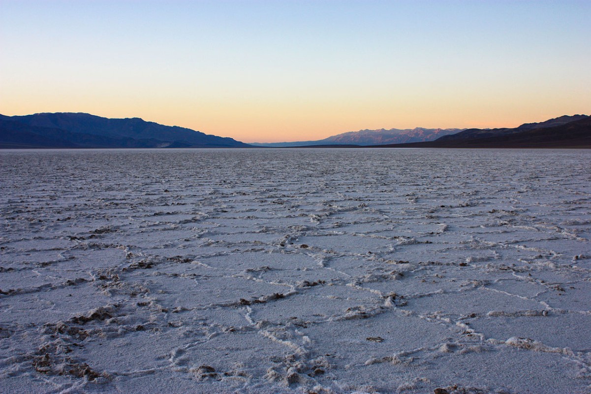
Record Rainfall For Death Valley
During a typical year, Death Valley, often deemed one of the hottest places on earth, receives as little as 2 inches of rainfall.
Source: Wikimedia
However, over the past six months, it has seen more than double according to the national park’s weather gauge situated at Furnace Creek. This has allowed Lake Manly to remain partially filled.
Once in a Lifetime Opportunity
Park Ranger Nicole Andler said Badwater Basin at Death Valley National Park, which runs along a portion of California’s border with Nevada, “is normally a very beautiful, bright white salt flat.”
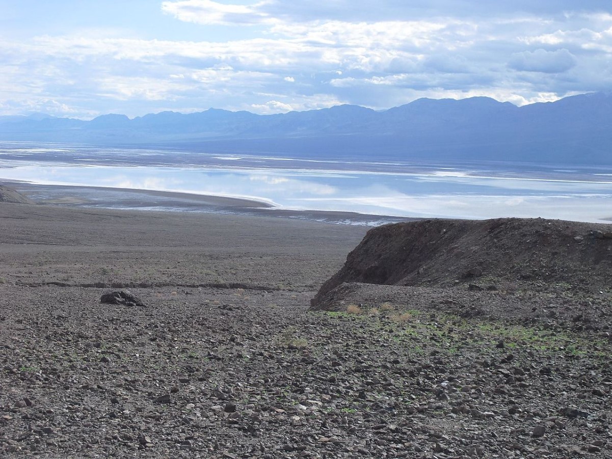
Source: Wikimedia
“It’s the lowest point in North America. So it’s going to collect water but to have as much water as we have now, and for it to be as deep and lasting as long as it has, this is extremely uncommon,” Andler said. “If it’s not once-in-a-lifetime, it’s nearly.”
Researchers Share Their Thoughts on Lake Manly
According to researchers working on behalf of the NASA initiative, the Lake grew significantly this year, reaching a depth that it attained following the hurricane back in 2023.
Source: Wikimedia
”Based on satellite imagery, the lake appears to have grown to a similar size in February 2024 as it did in August 2023, thereby extending its months-long tenure,” NASA said. As of February 14, the lake is 1 foot deep in places, according to park officials, and it is uncertain how long it will last,” they said.
Locals Surprised the Lake Not Disappeared
Locals living and working in the region, such as park ranger Abby Wine, revealed that they were surprised by how long the basin had remained filled with water.
Source: Phys.Org
“Most of us thought the lake would be gone by October. We were shocked to see it still here after almost six months. This week’s rain will extend how long the lake is here,” said Wine.
SWOT Can Help Researchers Better Understand Lake Systems
According to Tamlin Pavelsky, NASA’s freshwater science lead for SWOT, the satellite’s images showcase how it may help researchers better understand lake systems.

Source: Freepik
They said, “This is a really cool example of how SWOT can track how unique lake systems work.”
SWOT’s Greatest Strength
Because of its impressive Ka-band Radar Interferometer, SWOT is playing an integral role in mapping much of the Earth’s waters.

Source: Freepik
The satellite works by sending radar pulses toward surface water, “developing one of the most detailed and comprehensive views of the planet’s oceans and freshwater lakes and rivers.”
Data Collected By SWOT Helps Scientists Better Understand the Satellite
As per the author of an article published on Phys.org, the data collected by SWOT is helping scientists and engineers better understand how the new satellite works.

Source: Wikimedia
Pavelsky said, “We’ve never flown a Ka-band radar like the KaRIn instrument on a satellite before.”